TanDEM-X Derivative Products
In addition to the global TanDEM-X elevation model, the main concern of the TanDEM-X satellite mission, further derivative global products have been developed at the German Aerospace Center and made available to the public. We are happy to announce that the Global TanDEM-X Forest/Non-Forest Map is from now on available for scientific and non-commercial use. In addition, the launch of the Global Height Change Map is also planned in the future.
| Products |
|
 |
| Description |
|
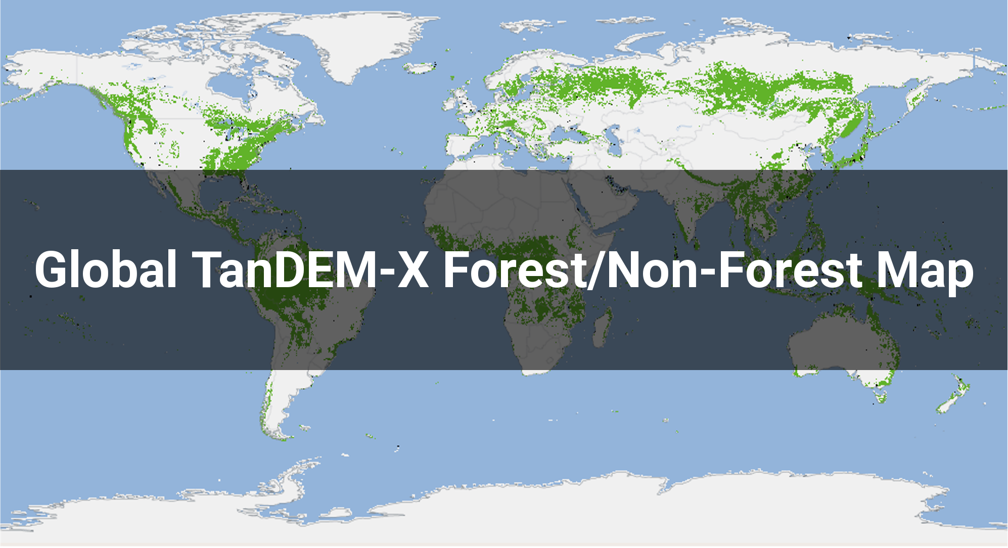
The Global TanDEM-X Forest/Non-Forest Map dataset is the result of a forest classification derived from bistatic interferometric TanDEM-X radar data acquired between 2011 and 2015 in Stripmap Single Polarization (HH) mode. All maps are provided as raster data sets in GeoTiff format with a constant ground resolution of 50 m x 50 m. The raster values in the GeoTiff files correspond:
- 0: urban areas and invalid pixels
- 1: forest areas
- 2: non-forested areas
- 3: water bodies
|
| Data Access |
|
The complete TanDEM-X Forest/Non-Forest Map is accessible without quota limitations and free of charge for scientific and non-commercial users. The data sets are housed on a DLR FTP server and can be accessed without registration via a web browser interface or a common FTP client software (e.g. FileZilla, cURL). |
| Further Information |
|
|