
|
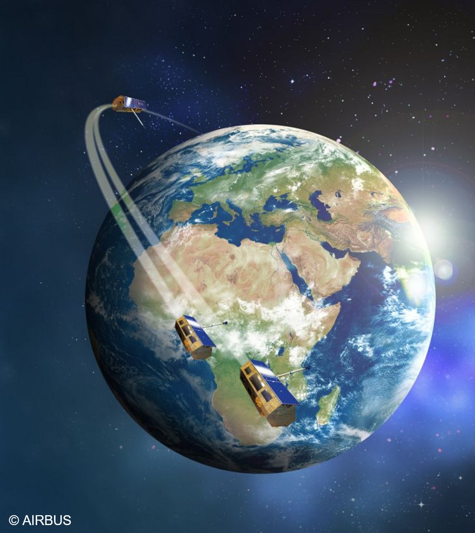
Science Service System |
|
|
You are here : Home
|

News
|
[March 01, 2024] Joint CSA, INTA & DLR Call: RADARSAT Constellation - PAZ - TerraSAR-X - TanDEM-X - Missions Start date: 2024-03-01 Due date: 2024-09-30 This Joint Call is intended to foster the joint scientific use of SAR products provided by RADARSAT Constellation Mission (RCM) (CSA), TerraSAR-X (TSM) (DLR), TanDEM-X (TDM) (DLR) and PAZ (INTA) missions, focusing on the evaluation of these sensors and missions for research on algorithms, methods and applications. |
|
|
Our objective is to explore the scientific possibilities of SAR products provided by the RCM, TSM and TDM and PAZ missions:
Investigators are requested to prepare their proposals taking into account the specific data acquisition sites where data of the corresponding mission have data already acquired over a longer time frame. Although it is a common AO, interested research teams shall submit their proposal to both, DLR and INTA, for the independent revision of each institution as well as the signature of PAZ EULA (for the use of PAZ scientific products). There is no need to submit a proposal to access RCM products since archived data at 16m and coarser over land is open to public. However, higher resolution data (5m, 3m, ...) requires to be a vetted users.
|
||

|
[November 22, 2023] TanDEM-X 30m Edited DEM (EDEM) & DEM Change Maps (DCM) freely available! As of today, two global data sets of the TanDEM-X mission are freely available for the scientifc community: |
|
|
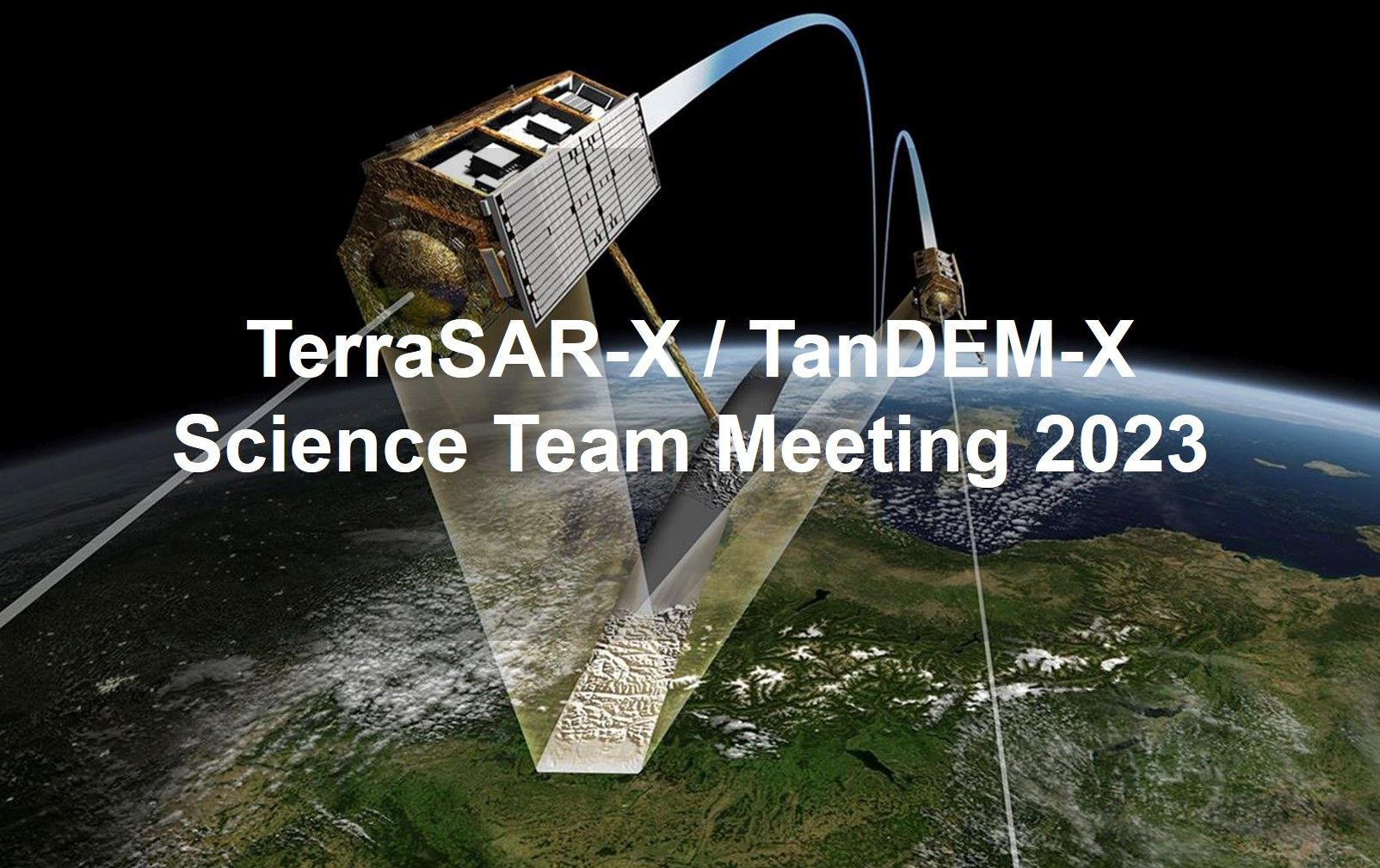
[April 03, 2023] TerraSAR-X / TanDEM-X Science Team Meeting 2023 The Microwaves and Radar Institute and the German Remote Sensing Data Center are pleased to invite you to the TerraSAR-X / TanDEM-X Science Team Meeting 2023 that will be held from Wednesday October 18th to Friday October 20th, 2023 at the German Aerospace Center in Oberpfaffenhofen. Further information: here Final Program (PDF), Status 2023-10-16 A agenda with download links to either the presentation/poster, or abstract, is available! |
|
|
[February 24, 2022] TanDEM-X Again In Operation We would like to inform you that TanDEM-X is since 16.02.2022 again in nominal operation. Proposal for new data acquisitions are again accepted and welcome. |
|
|
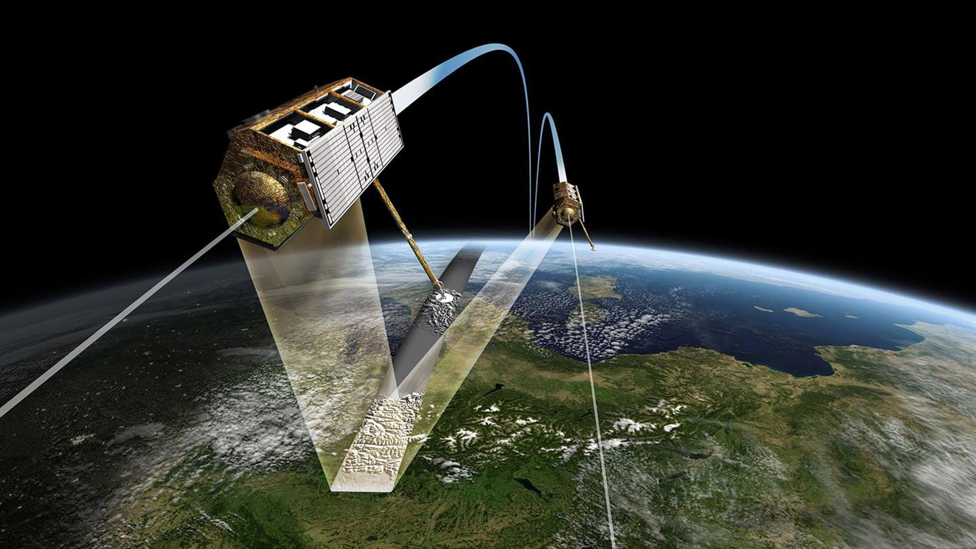
[May 04, 2021] Joint TerraSAR-X, TanDEM-X, PAZ Call This announcement of opportunity (AO) aims for the synergistic use of the two German satellites TerraSAR-X/TanDEM-X(TSX/TDX) of the TerraSAR-X/TanDEM-X mission, and the Spanish PAZ satellite of the PAZ mission. The AO is launched on May 2021 and will be open until December 31st. Since both platforms are almost identical and they were launched in the same orbital plane, comparable images of the same area under the same geometry may be regularly acquired by both systems. This allows the simultaneous exploitation of both missions for building larger time series and improving the revisit time of 11 days for each mission up to 4 or 7 days while combining both. For the data request a science proposal needs to be submitted to each mission. Please check the guidelines provided in the common INTA/DLR document for this call: Joint DLR-INTA Scientific Announcement of Opportunity Document For joining the call you have to submit two proposals, a CoSSC proposal here on this server for the TanDEM-X mission part (see basic instructions
here), and a separate proposal through the INTA/PAZ sciencia interface here: Literature: |
|
|
[March 22, 2021] Using principles from painting – creating 3D-effect satellite images in true colour How can an impression of three-dimensionality be created using a two-dimensional medium? In art, this question arose centuries ago. Certain painting techniques have since evolved to simulate effects of light and shadow, creating a 3D effect for the viewer. Such effects are referred to as trompe-l'śil – they 'deceive the eye'. [full article] |
|
|
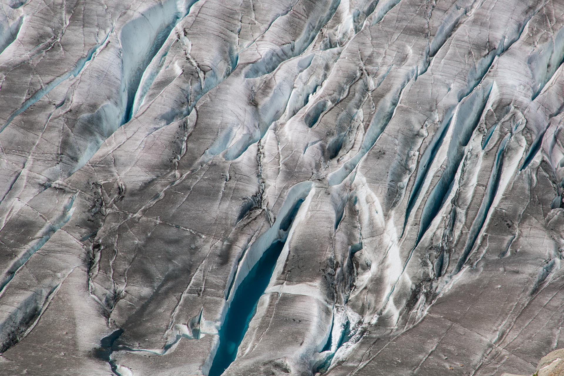
[July 08, 2020] Gletscherrückgang in den Alpen – erstmals flächendeckend dokumentiert Ein Forschungsteam der Friedrich-Alexander-Universität Erlangen-Nürnberg (FAU) untersuchte die Flächen- und Höhenänderungen aller Gletscher der europäischen Alpen über einen Zeitraum von 14 Jahren. Dazu verglichen sie dreidimensionale Geländemodelle der deutschen Radarsatellitenmission TanDEM-X und der deutsch-amerikanischen Shuttle-Radar Topography Mission (SRTM) aus der Zeit zwischen 2000 und 2014. [full article] |
|
|
|
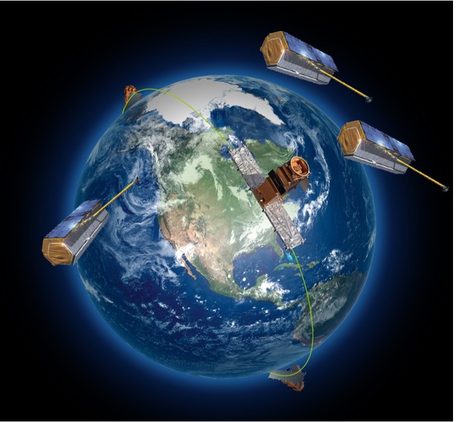
[June 25, 2020] Congratulations, TanDEM-X – 10 years of 3D mapping from space A new era in radar remote sensing began 10 years ago, on 21 June 2010, when the radar satellite TanDEM-X was launched. Since then, it has been orbiting Earth in close formation flight with TerraSAR-X, its three-year-older 'twin'. |
|
|
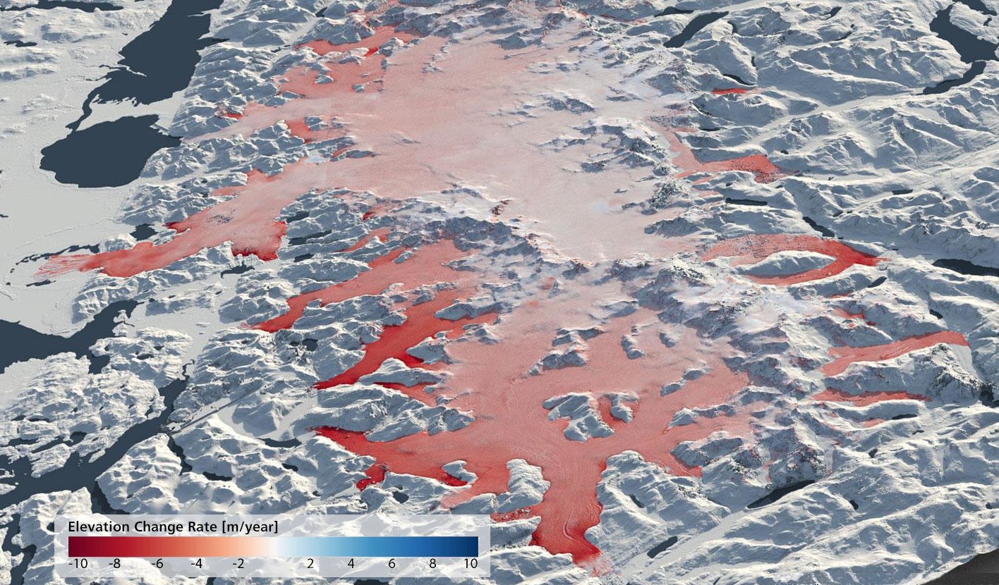
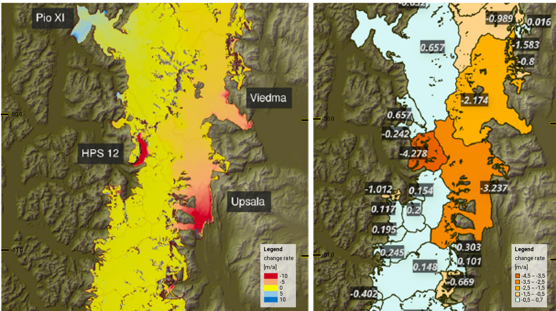
[December 10, 2019] Development of the Patagonian Ice Fields reveals the enormous complexity of physical interactions The glaciers and ice fields in the South American region of Patagonia have been in retreat since the Little Ice Age between the early 14th century and the mid-19th century. In recent decades, the loss of ice masses associated with tropospheric warming has accelerated. From 2000 to 2016 the Patagonian Ice Fields contributed approximately six percent to the eustatic sea level rise of 0.74 millimetres per year. |
|
|
[October 17, 2019] TerraSAR-X / TanDEM-X Science Team Meeting The Microwaves and Radar Institute and the German Remote Sensing Data Center are pleased to invite you to the TerraSAR-X / TanDEM-X Science Team Meeting 2019 that will be held from Monday October 21st to Thursday October 24th, 2019 at the German Aerospace Center in Oberpfaffenhofen. |
|
|
|
[September 13, 2019] Tidal glaciers in Greenland – TanDEM-X elevation models show strongest decline in 80 years The Kangerlussuaq Glacier is the largest glacier on the southeast coast of Greenland and flows into the fjord of the same name. The glacier front, which in the past was protected by an ice mélange – a mixture of sea ice and calved icebergs – is retreating at an increasing rate. The glacier calves approximately 24 cubic kilometres of ice into the ocean every year. This corresponds to about five percent of the amount of ice lost annually by the entire Greenland ice sheet. Using a time series of 150 TanDEM-X elevation models of the Kangerlugssuaq Glacier, scientists from Swansea University in the United Kingdom have measured the decrease in the glacier’s surface height. [full article] |
|
|
[June 12, 2019] TanDEM-X reveals glaciers in detail A precise understanding of glacier evolution requires knowledge of a glacier's exact mass. This is important in South America, in the tropical regions between Bolivia and Venezuela, where meltwater from glaciers provides drinking water during the dry season. However, basic data about mass changes in glaciers are not easy to obtain. Mass losses are also contributing to rising sea levels on a global scale. As a new analysis method using TanDEM-X data shows, this is particularly true for Patagonia. [full article] |
|
|
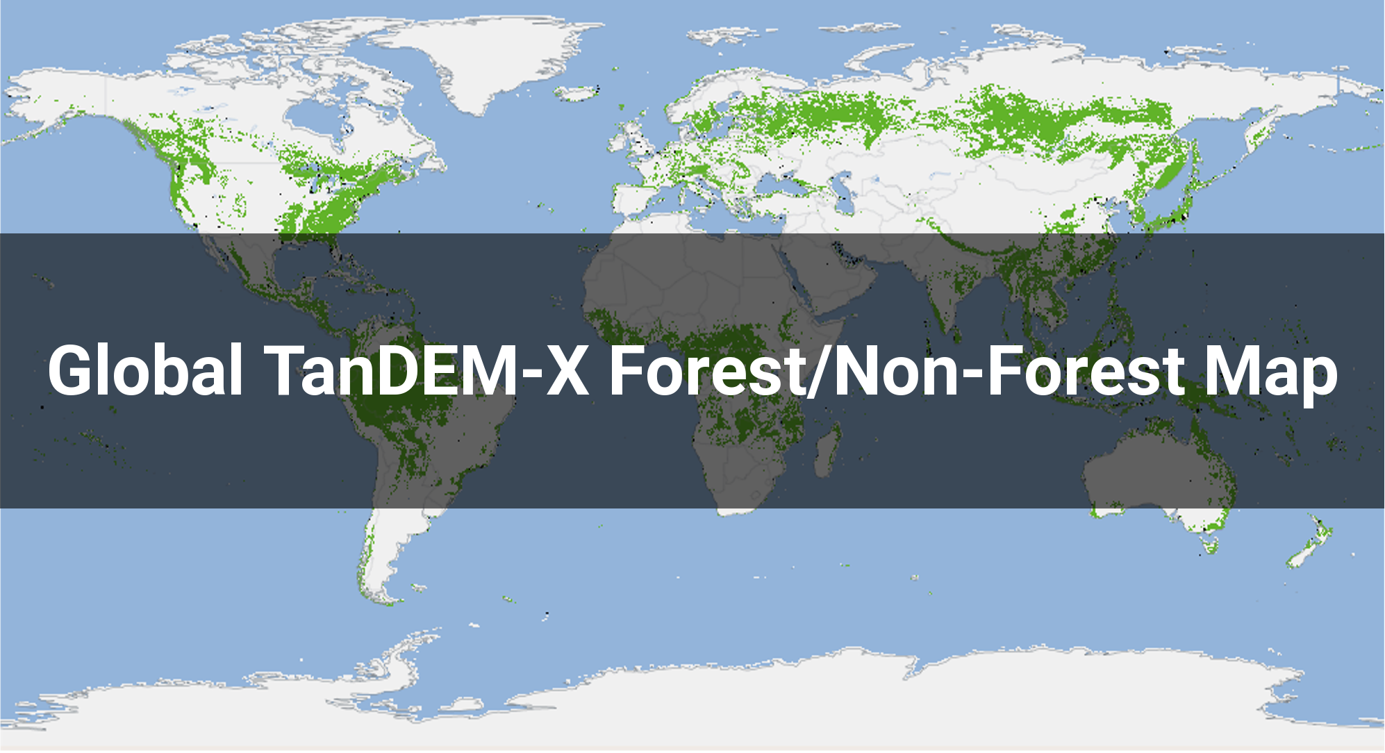
[May 06, 2019] Global TanDEM-X forest map is available Forests are Earth's lungs; they help to reduce greenhouse gas concentrations in the atmosphere and thus counteract global warming, while also providing protection and resources for humans, animals and plants – and they are being lost at an alarming rate. As the view from space reveals, forests cover about one third of Earth’s landmass today. More than half of the world’s forests, which have fallen victim to deforestation since the middle of the 20th century in particular, have already been lost. The German Aerospace Center (Deutsches Zentrum für Luft- und Raumfahrt; DLR) has created a special dataset to monitor, assess, and protect the current state and development of this green organ with precision – the global TanDEM-X Forest/Non-Forest Map. [full article] |
|
|
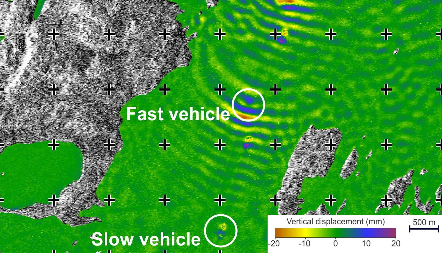
[March 13, 2019] Waves on the ice – Canadian 'ice road' trucks in TanDEM-X's 'radar eye' Ice road truckers in Canada – symbolically 'at the end of the world' – with their massive trucks travelling over the frozen lakes in the Canadian northwest, are well known around the world thanks to numerous TV programmes. The ice roads are open for only a few weeks per year. During this time, thousands of tonnes of freight are moved across these 'ice highways', as the frozen lakes in winter act as seasonal roads and provide an effective and economical way to reach remote communities and businesses in the coldest regions. [full article] |
|
|
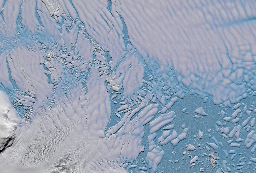
[February 01, 2019] Glacier retreat in Antarctica – innovative radar technologies enable improved predictions Thwaites Glacier, one of the most fragile glaciers in western Antarctica, is melting inexorably into the Amundsen Sea at an ever-increasing rate. Until now, it has been responsible for approximately four percent of the global rise in sea level and will cause the oceans to rise by over 65 centimetres in future as its remaining ice melts. With the German radar satellites TerraSAR-X and TanDEM-X, it is now possible, for the very first time, to observe Thwaites Glacier and other polar regions at regular intervals, with high resolution and in three dimensions. [full article] |
|
|
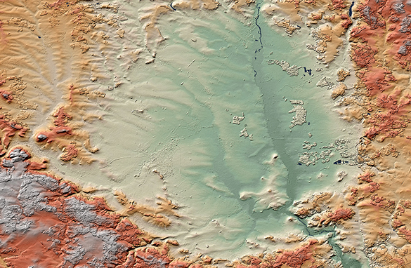
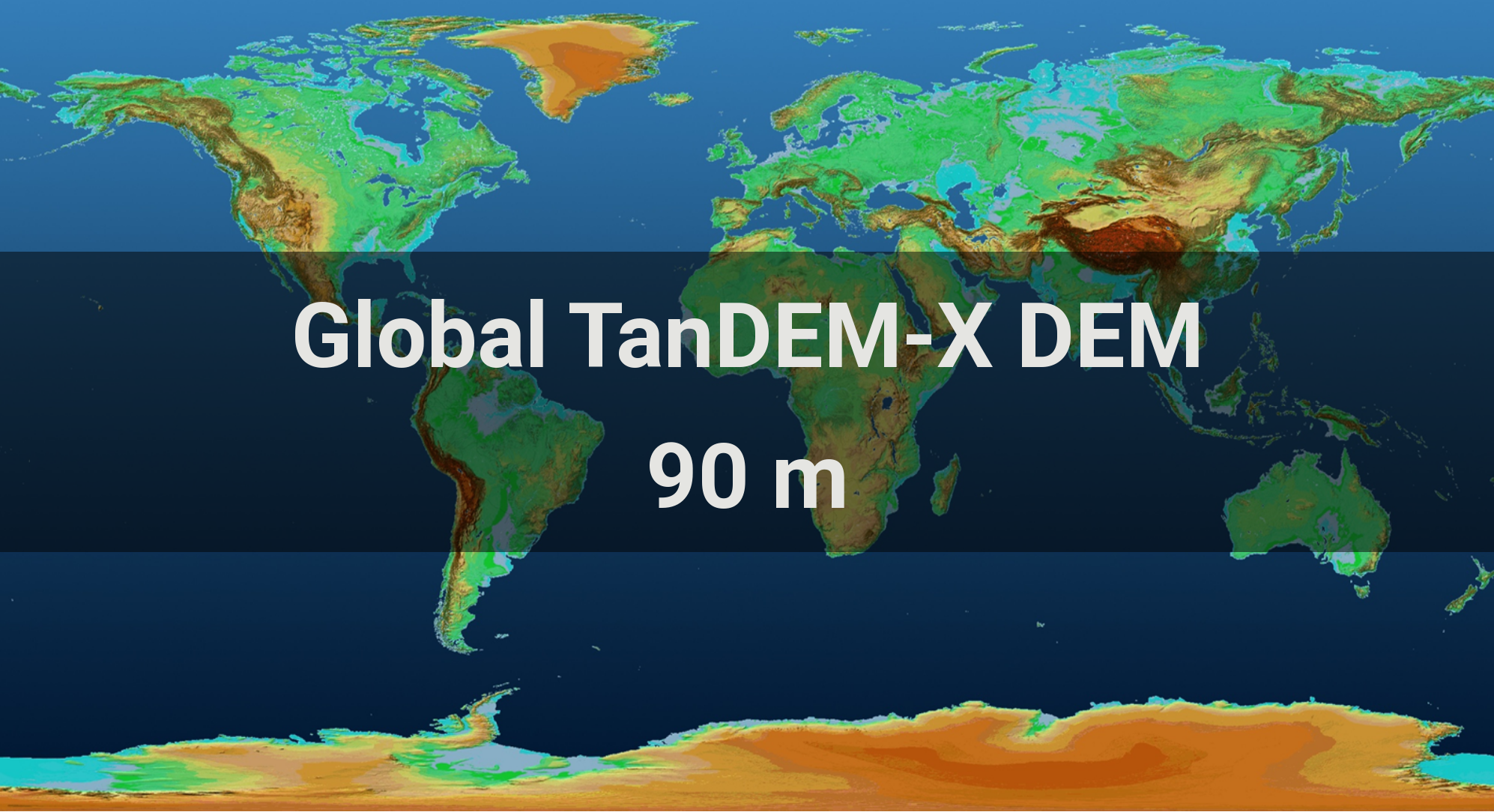
[October 08, 2018] Global 3D elevation model from the TanDEM-X mission now freely available The 90-metre TanDEM-X Digital Elevation Model has been released for scientific use and is now available as a global dataset. By providing this data, the German Aerospace Center follows the EU data policy under the Copernicus Earth observation programme, which encourages free and open access to satellite data. [full article] |
|
| © DLR, 2006-2021 |
|