
|
Science Service System |
|
|
You are here : Home
: TanDEM-X Science Service System
|

TanDEM-X Basic Products
| TanDEM-X Products | |||
|---|---|---|---|
 |
 |
 |
|
| Description | |||
The global TanDEM-X Digital Elevation Model with a pixel spacing in latitude direction of 0.4 arcsecond and 1.0 arcsecond, corresponding to approximately 12 m and 30 m, has been generated over all land surfaces with a relative vertical accuracy of 2 m (slope < 20%) and an absolute vertical accuracy of 10 m. The elevation values represent the ellipsoidal heights relative to the WGS84 ellipsoid in the WGS84-G1150 datum. The TanDEM-X Digital Elevation Model is not edited and therefore can contain radar and processing artefacts as well as voids. |
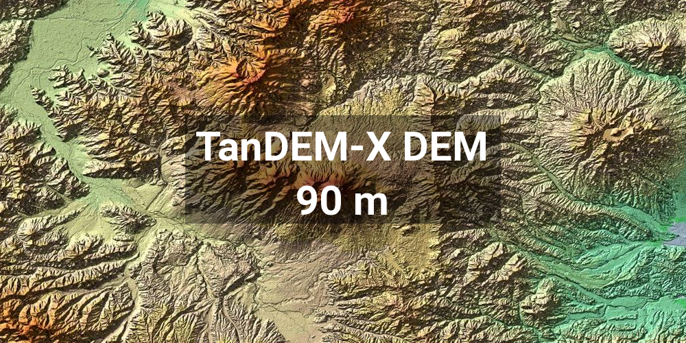
The global 90 m TanDEM-X Digital Elevation Model with a reduced pixel spacing of 90 m was derived as a multi-looked version from the global 12 m TanDEM-X DEM. The 90 m TanDEM-X DEM is not edited and can contain radar and processing artefacts as well as voids [more]. |
The Coregistered Single look Slant range Complex (CoSSC) data are the basic SAR products of the TanDEM-X mission. They are used from experts to generate higher level products and are also used as a basis to generate the TanDEM-X DEM. In the stripmap mode these simple two SAR images (single look slant range) have a spatial resolution of 3x3 m and are coregistered. |
|
| Data Access | |||
The 12 m and 30 m global TanDEM-X DEMs can be ordered by scientific users via a proposal submission. After a successful evaluation of the submitted proposal, the requested data can be provided free of charge. Only for proposals that were submitted after December, 7th 2016, a service fee will be charged. |
The complete 90 m TanDEM-X DEM is accessable without quota limitations and free of charge for scientific use. The data sets are housed on a DLR FTP server. After a simple registration the user account is generated. With the user account, the data sets can be accessed via a web browser interface or a common FTP client software (e.g. FileZilla, cURL). |
CoSSC data can be ordered here by scientific users via a proposal submission. After a successful evaluation of the submitted proposal, the requested data can be provided free of charge. Only for proposals that were submitted after December, 7th 2016, a service fee will be charged |
|
| Further Information | |||
| © DLR, 2006-2021 |
|